The Enchantment Lakes area of Washington State, commonly referred to as the Enchantments, is an ideal place to indulge in the majesty of Mother Nature. Bring a good pair of hiking boots and prepare to be amazed by the views. (Read More)
The Enchantment Lakes area of Washington State, commonly referred to as the Enchantments, is an ideal place to indulge in the majesty of Mother Nature. Bring a good pair of hiking boots and prepare to be amazed by the views. (Read More)
The Enchantment Lakes area of Washington is a high alpine basin that lures outdoor enthusiasts in with its scenic lakes and jaggedly-beautiful mountain summits. Side trails wind their way around the area and provide excellent tracks for day hikes, and visitors who don't want to leave when the sun starts to set can find plenty of places to set up camp. Some call this the best hiking in the state, so you might consider lingering for a while. In other words, if you have the time, you might try to get a backpacking permit that is good for a few days so that you can fully enjoy the masterpiece that is Enchantment Lakes landscape. Arguably the best time to visit is in the fall when the larch trees are changing color.
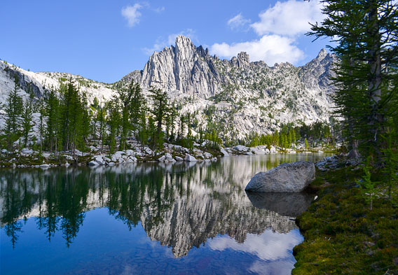
Enchantment Lakes
Numerous alpine lakes are found in the Enchantment Lakes area. Examples include Colchuck Lake and Tranquil Lake. Colchuck Lake is an excellent place to take a break from hiking in the upper basin territory. While resting and recharging, those who make it to this lake are greeted with up close views of Colchuck Peak and Dragontail Peak. Tranquil Lake is also located in the upper basin area and is a recommended spot to refill your water supply should you need to do so. Other lakes that are responsible for inspiring the name of the Enchantments Lakes area include, but are not limited to, Isolation Lake, Perfection Lake, Nada Lake and the upper and lower Snow Lakes. Campsites can be found along or near some of the lakes. Just remember to bring bug spray if you are camping here in the summer. Also, there are permit requirements for the area, which we discuss below.
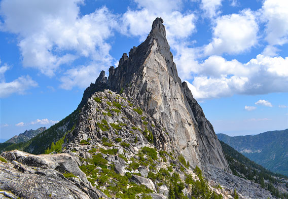
Upper Enchantments
The Upper Enchantments area is more austere and rugged than the Lower Enchantments. Some go as far as to refer to the alpine scenery up here as something almost unworldly. It takes a good amount of effort to get up to the very top of the upper reaches. The route along the Aasgard Pass that leads into the upper portion of the Enchantments climbs 2,200 feet in less than a mile, which should give you a good idea of the workout that you will get if you choose to take it on. Among the bodies of water that are found at higher elevation are Perfection Lake and Gnome Tarn.
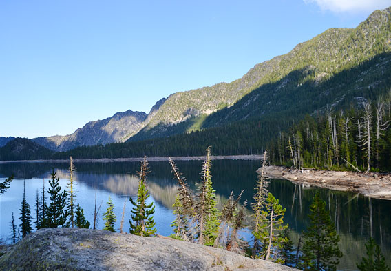
Lower Enchantments
The Lower Enchantments area tends to be more tame, if you will, than the decidedly more rugged, alpine area of the Upper Enchantments. On the whole, the trails at lower elevations are less grueling, though you can expect a good workout if you want to transition to higher land. The lower you are, the more that the terrain will be characterized by forested trails and meadows. The lakes down lower are also more likely to be surrounded by trees instead of granite peaks. Since it is more accessible, the Lower Enchantments area is very popular with day users.
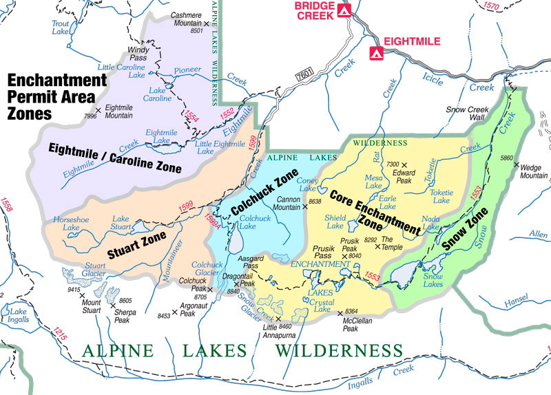
Getting an Enchantment Lakes Permit
In 1987, the Forest Service enacted a permit system for the Enchantment Lakes area. Permit requirements are still in place to this day, though they differ depending on the time of year. During the peak June 15 to October 15 period, permits must be obtained for overnight camping in one of five specific zones - the Core Enchantment Zone, the Snow Lake Zone, the Colchuck Lake Zone, the Stuart Lake Zone, and the Eightmile/Caroline Permit Zone. The majority of the Enchantment Lakes permits for overnight camping during the peak visiting season are awarded in advance by lottery starting in February. The rest are issued each morning, except on Sundays, at the Wenatchee River Ranger District station for trips that begin that same day. If there aren't enough permits to cover a specific day's applicants, a lottery system is again activated. During the peak season, day users in the Enchantments only need to secure a self-issued, walk-in permit, either at the ranger station or at the trailheads. Outside of the peak visiting period, similar permits are all that are required for day users and overnight visitors. The address for the Wenatchee River Ranger District station is 600 Sherbourne in Leavenworth, Washington. Click here for comprehensive permit information and other things that you should know before you go.
Aasgard Pass
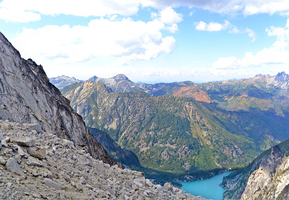
No discussion about the Enchantment Lakes area of Washington would be complete without covering Aasgard Pass, which is officially designated as Colchuck Pass. As noted above, this mountain pass that separates Colchuck Lake from the Upper Enchantment Basin climbs 2,200 feet in less than a mile. Steep is a word that describes the ascent, and hikers will have to navigate through some relatively tricky terrain. The starting elevation for Aasgard Pass is 5,570 feet. Those who make it all the way to the top will find themselves at an elevation of more than 7,500 feet. It almost feels like being on top of the world, with only Dragontail Peak and a large ridgeline rising higher in terms of the features in the more immediate area. Further off in the distance are the North Cascades and Mt. Baker.
Gnome Tarn
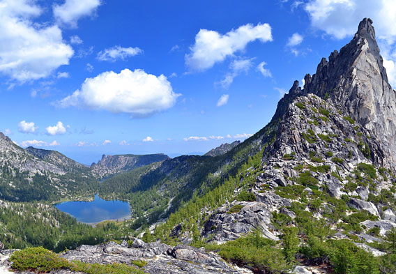
Another notable feature in the Enchantments area is Gnome Tarn. A tarn, for those who may not know, is a mountain lake or pool that forms in a cirque that has been dug out by a glacier and erosion. What makes Gnome Tarn so special is the views of Prusik Peak, which rises up on one side of the small body of water. The reflections of Prusik Peak in the water help to make Gnome Tarn one of the most photographed spots in the Enchantment Lakes area.
Back to top © Dan Taylor/Destination360. All Rights Reserved